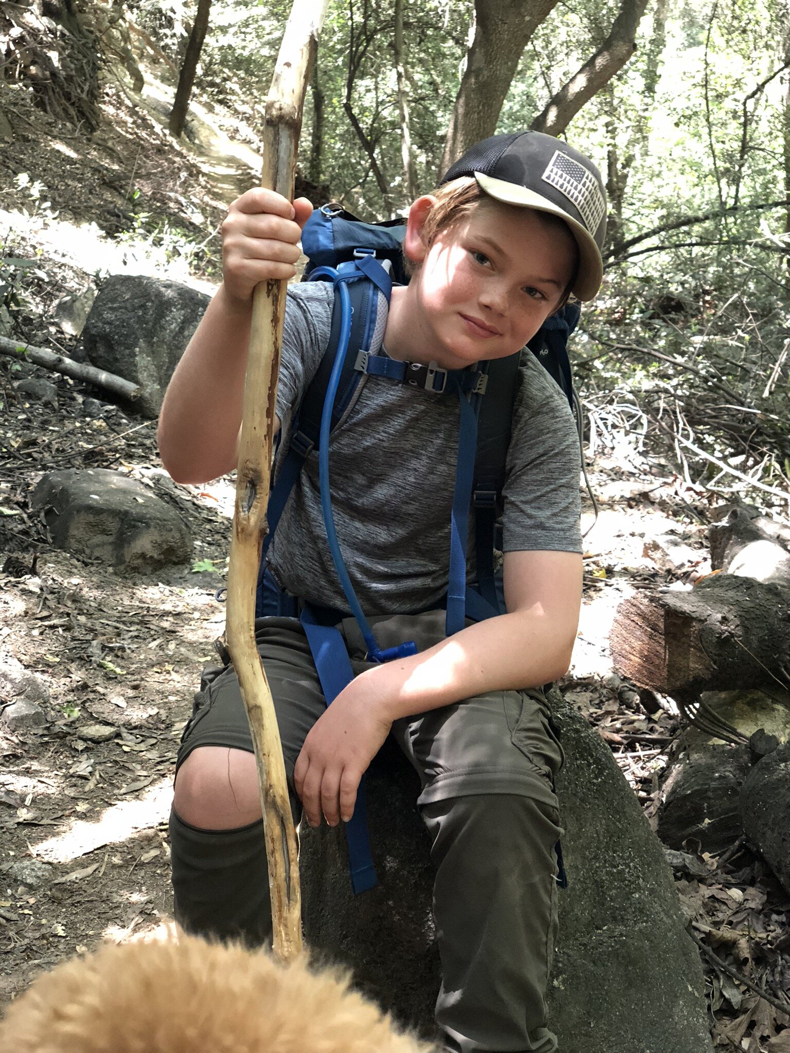
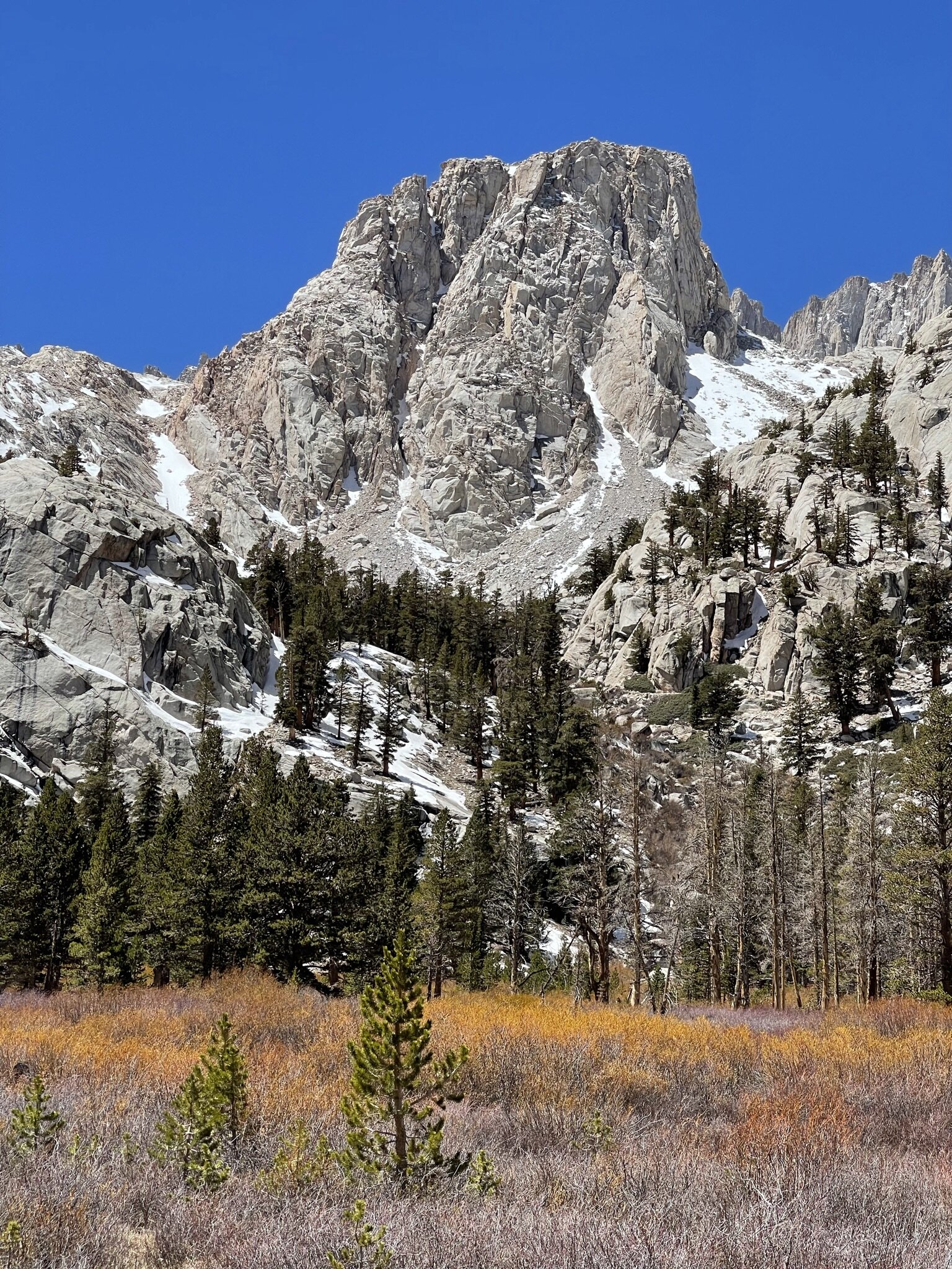
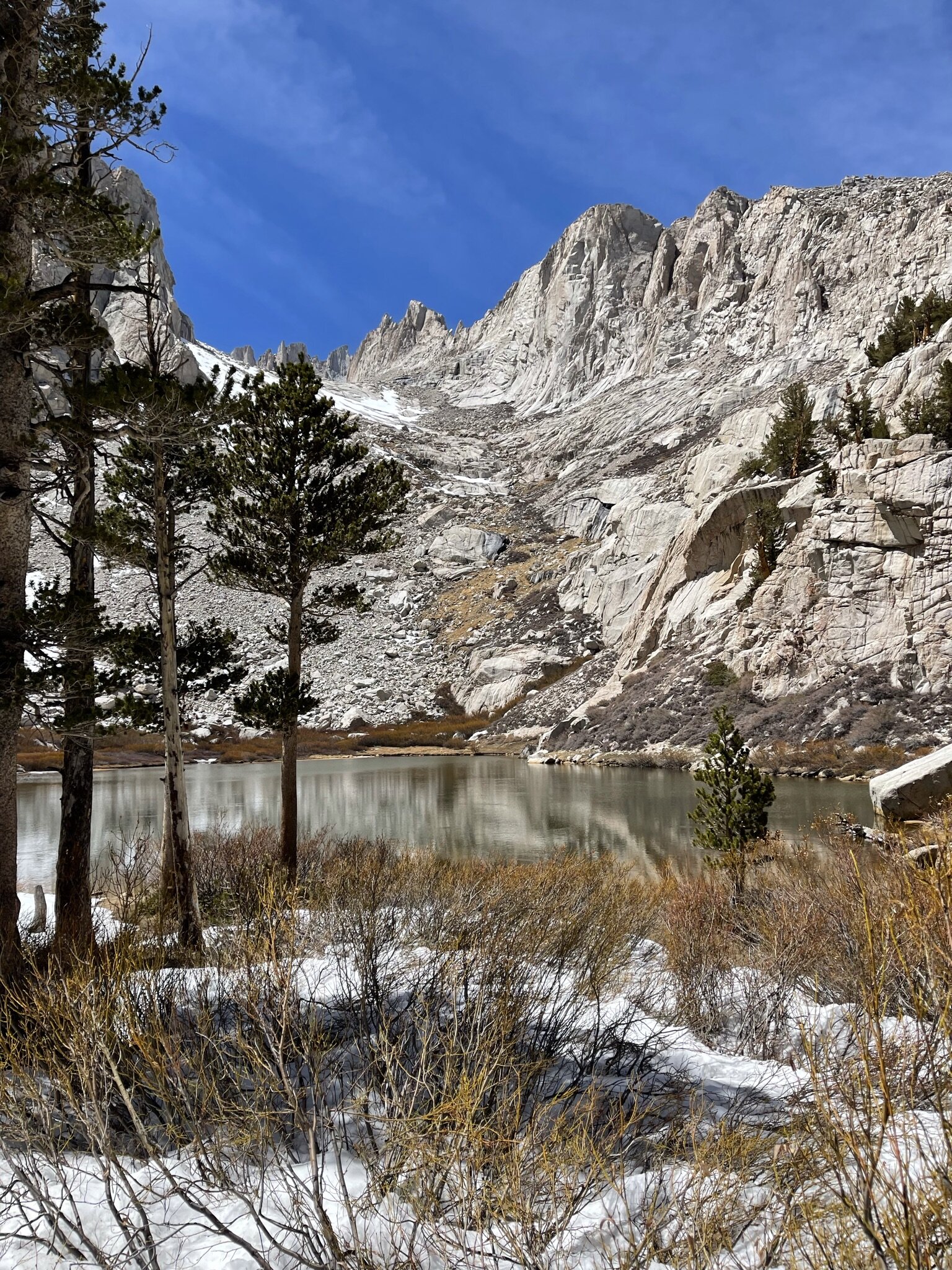
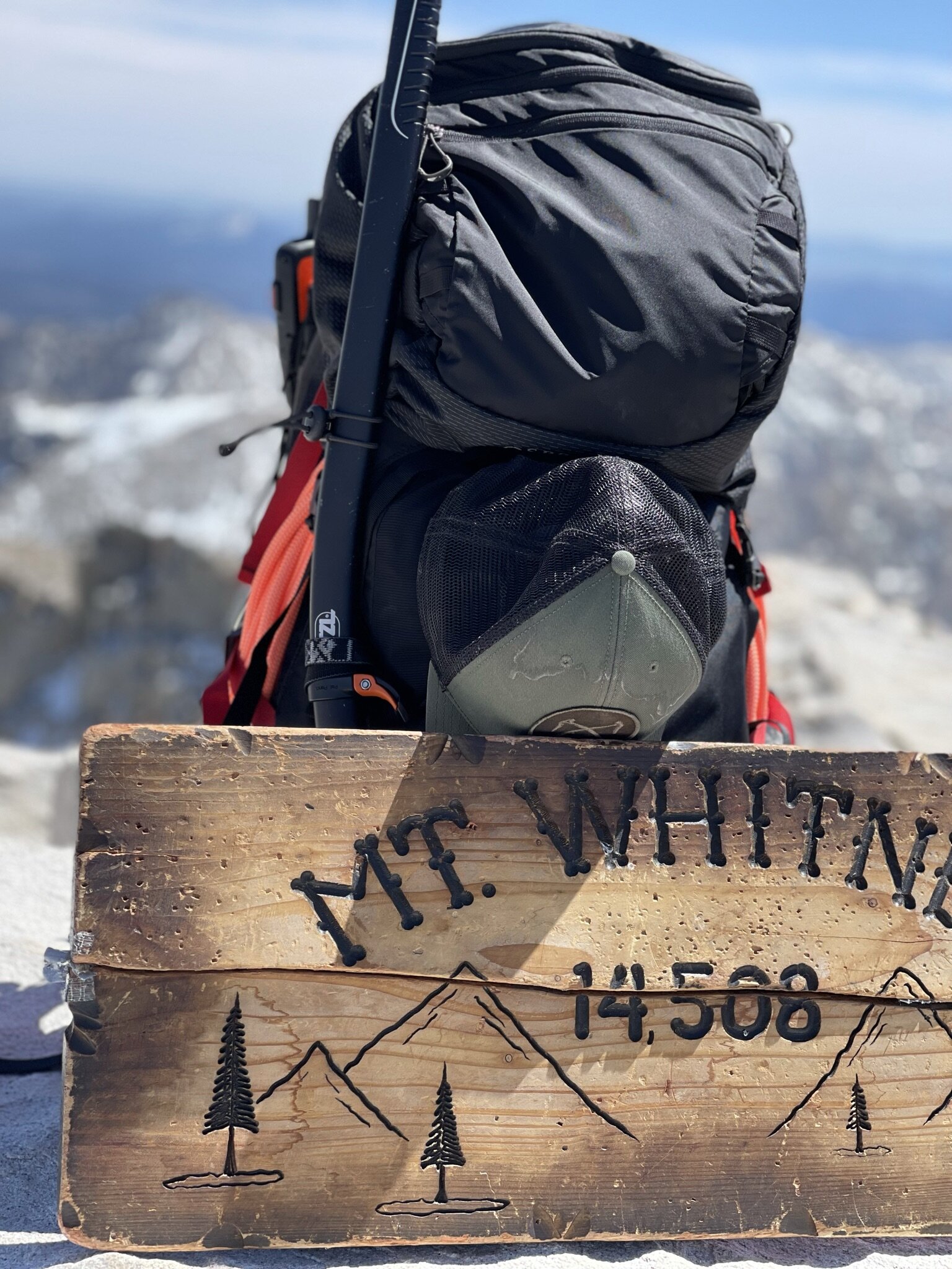
Mount Whitney
It all begins with an idea.
21 miles / 6,647’ elevation gain / 3 days / 14,508’ summit

Mount Whitney not a starter mountain. It is the highest mountain in the lower 48 states and should only be done after you have properly trained for a mountain of its stature. It’s important to remember that climbing at altitude requires acclamation. It doesn’t matter what great shape you’re in, altitude can affect everyone in serious way. If you are able to summit this gorgeous mountain made of rock spires and trees, not only will it give you a feeling of accomplishment that will fuel your drive for the rest of the hike but, it proves you can start attempting some of the biggest mountains around the world. Mount Whitney’s trail takes you through dense, old growth forest, past beautiful alpine lakes, through a vast canyon surrounded by rocky fingers higher than any building on the planet. It’s like something out of a storybook. Of all the mountains I have climbed in my life, this is my favorite hike and I will do it again and again, each time learning something new about myself.


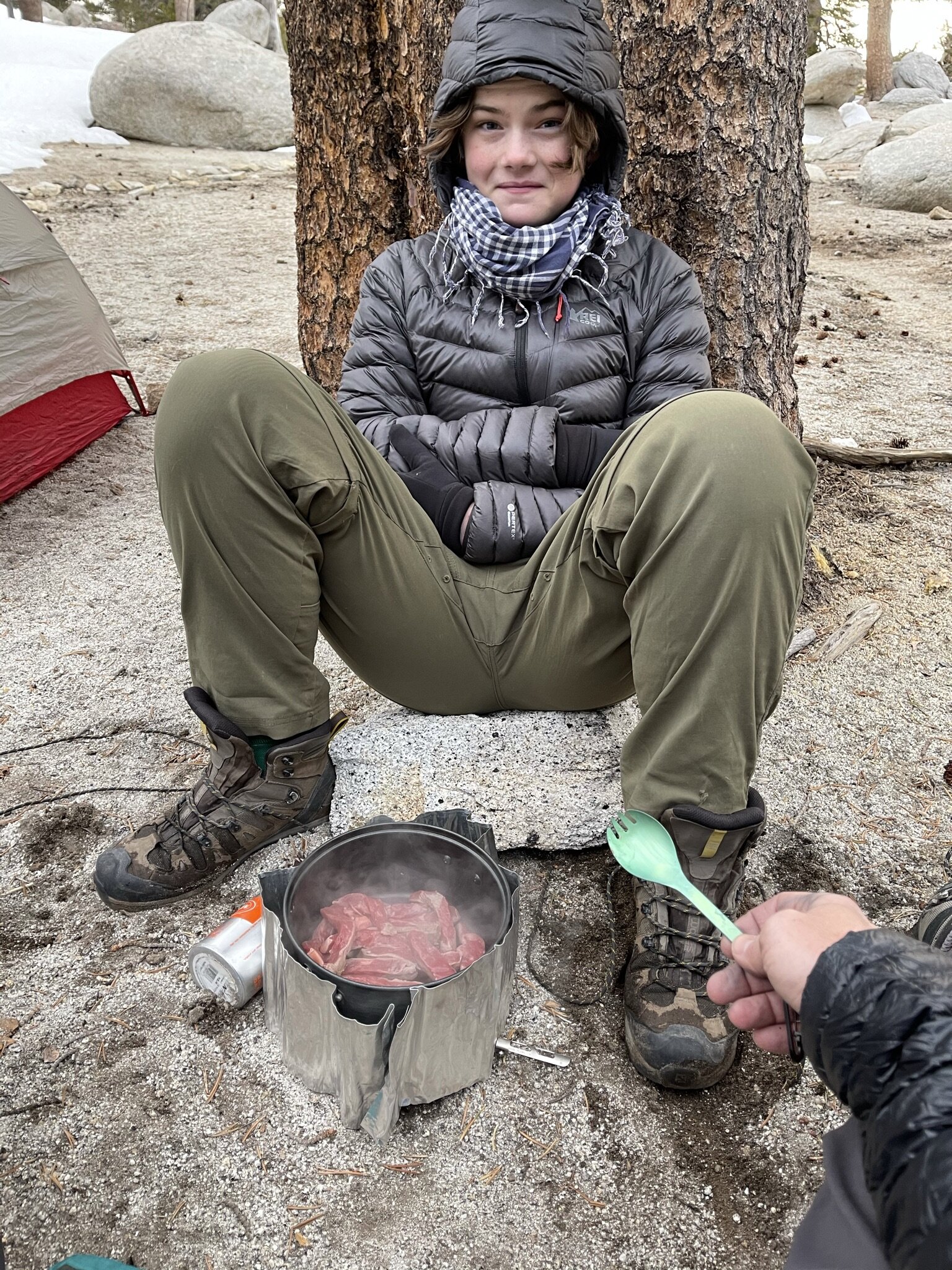
Mount San Jacinto
It all begins with an idea.
13.1 miles / 4,521 elevation gain / 12.5 hrs / 10,834 summit

Mount San Jacinto is a beautiful mountain. The trails on this masterpiece of nature were super steep but, the hike itself isn’t too long. The mountain was about 5 to 6 miles from the parking lot to the summit. However, I highly suggest taking two days to climb Mount San Jacinto because it is much more fun to take your time than rushing up and down. There’s so much to take in that a speed climb doesn’t do it justice. It’s also a really fun mountain to sleep on. Keep in mind, Mount San Jacinto’s only water source comes from snow melt. So, if you’re climbing spring/summer you’ll need extra water. If you’re climbing fall/winter you can use your water filter to get drinking water from the snow run off, or the snow itself. One of the coolest parts about San Jacinto is its summit. The very top is basically a pile of irregularly shaped boulders that you have to scramble up to reach the peak. Once there you are able to see a full 360 degree view from the LA basin to Palm Springs and beyond. This mountain was truly amazing. It’s luscious and untouched by modern tech and society. This mountain is best for hikers who have built up their endurance. It’s a lot of elevation gain in a short period of time but, if you’re able to complete it the effort is entirely worth your while.


Cucamonga Peak
It all begins with an idea.
11.6 miles / 4,300’ elevation gain / 10 hrs / 8,859’ summit

Cucamonga Peak would not be considered a technical climb. If there is no snow, you are simply following a clearly defined path from the trail head to the summit. It’s 12 miles roundtrip which can be done in one day however, there are a number of campsites for overnight stays which makes the whole trip more of an adventure. Cucamonga is not an easy hike but, compared to the other mountains in the San Bernardino range, it’s not as strenuous. Cucamonga is cool because you start off hiking a canyon trail spotted with cabins still in use along with the remains of 100-year-old cabins destroyed by flood and fire. You hike through a narrow canyon until you reach what is called the Ice House Saddle which is a flat transition point between four different trails. It’s great place for lunch. From the saddle, the trail opens up to incredible views of untouched valleys, curves around another mountain, stops at a smaller saddle and then you transition to the steepest part of the hike, a barrage of switchbacks that take you all the way to the summit. One you reach the top you can see the the entire Inland Empire, which at night lights up like a thousand stars. It’s actually kind of cool because you’re both deep in the wilderness and right on top of a city.


Mount Baldy
It all begins with an idea.
10.6 miles / 3,953’ elevation gain / 13 hrs / 10,066’ summit

Mount Baldy, or Mount San Antonio, is one gigantic loop that offers several different climbing options. The entire loop is 12 miles or you can do half the loop and come in and out the same way. Mt. Baldy has so many unique features from a waterfall and a boulder forest to the iconic Baldy Bowl on the south side of the mountain that looks like a natural amphitheater formed from glacial erosion. Half way up the mountain is the San Antonio Ski Hut. The Ski Hut is a tiny, green cabin built in 1936 run by the Sierra Club that is used for overnight stays for up to 16 people. The hut is a fully equipped mountaineer’s cabin with a full kitchen, first aid station and bunk beds in the attic. Sierra Club members can reserve space in advance but anyone is allowed to stay there. Past the Ski Hut is when the most challenging part of the hike begins because the terrain becomes much more steep. To give you an idea you climb over 2000 feet in elevation in just a one and a half miles. That’s a lot! During that time there’s the illusion of multiple false summits where you think you’re reaching the peak only to realize there’s another one hidden behind it. The summit of Mt. Baldy itself is completely barren of trees and filled with flat, slate rocks that people have built into wind breaker walls. It has 360 degree views of the San Bernardino mountain range. Once you’ve summited the mountain you can either go down the way you came or, cross what is called the Devil’s Backbone and finish the loop coming out through the Mt. Baldy ski resort. The Devil’s backbone is an extremely narrow ridge line trail that can be deadly in the wrong conditions. However, in the spring and summer months the backbone offers the most stunning views of the Baldy Bowl on one side and the valley on the other. If you can safely traverse it, it is absolutely worth the effort. The only drawback to this side of the loop is the last two miles which are a flat, gravel, fire road that is boring to look at and brutal on the knees. With the exception of the fire road, the entire Baldy experience will be something that you can remember for the rest of your life.

Big Pine
12.2 miles / 2785’ elevation gain /10 hrs / 12,000’ summit

Big Pine is in the Eastern Sierra Mountain range and home to multiple, gorgeous alpine lakes. The trail we did was 12 miles long and took us to the first two, of seven, alpine lakes literally called, First Lake and Second Lake. The terrain is moderate with open meadows and lots of water features and a handful of steep switchbacks. One of the coolest parts of this hike was being able to swim and fish in the pure, turquoise mountain water. Overlooking Second Lake is a popular rock climbing destination called Temple Crag that towers over the landscape. Rock climbers from around the world come to climb this 13,000 foot behemoth. This was a very pleasant day and a well recommended hike for anyone who wants a California alpine experience.


Mount Wilson
It all begins with an idea.
15.3 miles / 4,610’ elevation gain / 11 hrs / 5730’ summit

We showed up at Mt. Wilson with the goal to complete it in one day. It’s a 15 mile loop so it was a bit ambitious. The hike is not technically difficult or challenging, simply long with no specific place where you can just pitch a tent. The hike is scattered with beautiful waterfalls, babbling brooks, foot bridges and forest canopies. Although these days, I’m not entirely sure what is left of all of that after the most recent California fires. Mount Wilson is home to the Mount Wilson Observatory that you can actually drive to but it’s a lot more fun to earn the victory of seeing the observatory when you reach the summit by foot. Another treat that comes with the summit is the observatory restaurant where we dined on hot dogs and apple pie before soaking in the views and heading back down.